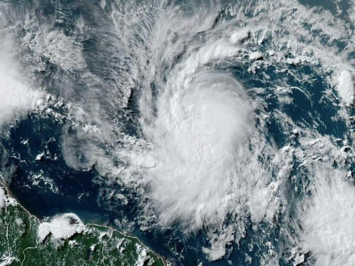
A large part of the southeastern Caribbean is on alert, threatened by Hurricane Beryl, the first of the 2024 season, which was located late Saturday afternoon about 1,350 km southeast of the French island of Martinique, according to the American and French meteorological authorities.
Beryl, which is currently moving in the Atlantic Ocean, is located approximately 955 kilometers east of Barbados, and it will become a “dangerous major hurricane” reaching the Windward Islands late Sunday or Monday, warned the National Hurricane Center (NHC) in Miami (United States), which is the reference in the Atlantic basin.
Barbados has been placed on cyclone alert, while Saint Lucia, Saint Vincent and the Grenadines and Grenada have all been placed on cyclone watch, the NHC said in its latest advisory. Tropical storm warnings or watches are in effect for Martinique, Tobago and Dominica.
Global warming is making extreme weather events, like hurricanes, more frequent and more devastating.
In Bridgetown, the capital of Barbados, cars lined up at gas stations, while supermarkets and grocery stores were crowded with customers coming to buy things like food and water. Some residents began to protect their homes.
“Atmospheric and oceanic conditions are favorable for continued intensification over the next two days: Béryl should reach major hurricane stage before passing over the Lesser Antilles”indicated the Météo France website at 5:30 p.m. local time (9:30 p.m. GMT).
The centre of the storm is expected to pass between Grenada, the southernmost island, and Saint Lucia, the northernmost island, during the day on Monday, according to French weather services.
Gusts of wind, heavy precipitation
According to the NHC, “wind gusts will reach a maximum of 100 km/h with stronger gusts”.
“Hurricane conditions are expected in the hurricane warning area beginning Sunday evening.”it said, warning of heavy rain, flooding, potentially deadly winds and storm surges, which could raise water levels up to 2.1 meters above normal .
A major hurricane is a Category 3 or higher hurricane, with winds reaching 110 mph (178 km/h). Experts say such an event so early in the hurricane season — which runs from early June to late November in the United States — would be very rare.
As of Friday, the prefect of Martinique put the island’s departmental operational center on standby, the French territory most threatened by the probable trajectory of the storm, his office announced.
“It is already very likely that the sea state will be very rough from Sunday evening, and particularly during the day on Monday.”for their part anticipated the services of the French State in Martinique.
Waves of 5 metres are expected in the Saint Lucia Channel, south of the French island.
The 2024 hurricane season is announced by Météo France as “one of the most intense years”The National Oceanic and Atmospheric Administration (NOAA) also predicted an extraordinary season in late May, predicting the possibility of four to seven Category 3 or higher hurricanes.
These forecasts are notably linked to the expected development of the La Nina weather phenomenon in the near future, as well as very high temperatures in the Atlantic Ocean, NOAA said.


